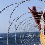
Gone are the days when a ship navigation officer had to take help of unconventional ways to plan and navigate a voyage at sea. Today, a ship officer has myriad of marine navigation equipment which makes his life a lot simpler, thanks to the advancement in technology. Moreover, present-day seafarers are trained so as to know the functioning and operation of all modern day navigational equipment that has made the journey at sea smoother and safer.
With modern day facilities and automation, a ship today has several advanced navigation equipment systems which give accurate data for the voyage.
Herein, we have enlisted 30 types of navigational equipment, both old and new, which are present on all merchant ships.
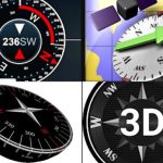
1. Gyro Compass
It is used for finding the right direction. Unlike magnetic compass, gyro compass is not hampered by an external magnetic field. It is used to find the correct North Position, which is also the earth’s rotational axis to provide a stable directional source. Its repeater system must be present in the steering platform for emergency steering.
2. Radar
The seagoing vessels depend on S-band and X-band frequency radar system for navigation as it can detect targets and display the information on the screen such as the distance of the ship from land, any floating objects (an island, rocks, iceberg etc.), other vessels, and obstacles to avoid a collision. It is a rotating antenna which discovers the surrounding area of the ship.
3. Magnetic Compass
The magnetic compass work in conjunction with the magnetic field of the earth and is the essential means of the direction indicating device. It is used to get a planned course for the voyage. This ship navigation equipment is usually fitted at the centre line of the ship on the monkey island. A transmitting magnetic type compass is fitted so that the output can be displayed in the bridge panel.
4. Auto Pilot
The ship bridge layout is filled with equipment and tools used for navigation. The autopilot is considered to be one of the most effective bridge navigational equipment as it assists the human operator in controlling the ship by keeping the steering in autopilot, which allows them to concentrate on broad aspects of the operation.
It is a combination of hydraulic, mechanical, and electrical system and is used to control the ship’s steering system from a remote location (Navigation bridge).
5. ARPA
Automatic Radar Plotting Aid displays the position of a ship and other vessels nearby. The radar displays the position of the ships in the vicinity and selects the course for the vessel by avoiding any kind of collision.
This bridge navigational equipment constantly monitors the ship’s surrounding and automatically acquires the number of targets, in this case; ships, boats, stationary or floating objects etc., and plot their speeds and courses respectively. It also presents them as vectors on the display screen and constantly update the parameters with each turn of the antenna by calculating their nearest points of approach to own ship and also the time before this will occur.
6. Automatic Tracking Aid
Just like ARPA, automatic tracking aid displays the information on tracked targets in graphic and numeric to generate a planned layout for a safer and collision-free course.
Usually, A large size target measuring 800 m or more in the circumference is considered as a landmass and not tracked. Echoes less than 800 m are deemed as targets to be tracked.
7. Speed & Distance Log Device
This bridge equipment on a ship is used to measure the speed and the distance travelled by a ship from a set point. By calculating the same, ETA of the ship is adjusted or given to the port authority and agent.
8. Echo Sounder
There are many modern ship navigation tools present on ship and echo sounder is one of the instruments which has been in the play from almost 100 years now. It is used to measure the depth of the water below the ship’s bottom using sound waves which work on the principle of transmission of sound waves and an audio pulse which will bounce off a reflecting layer, returning as an echo to the source.
9. Electronic Chart Display Information System
ECDIS is a development in the navigational chart system used in naval vessels and ships. With the use of the electronic navigation equipment, it has become easier for a ship’s navigating crew to pinpoint locations, and attaining directions are easier than before.
10. Automatic Identification system
AIS is also among the types of a navigation system which helps to pinpoint the location and other navigational statistics of ships. AIS uses VHF radio channels as transmitters and receivers to send and receive messages between ships which endeavours to fulfil a lot of responsibilities.
As per the regulation enforced by The International Maritime Organisation (IMO), all passengers’ vessels and commercial ships over 299 Gross Tonnage (GT) sailing in the international to carry a Class A AIS transponder.
11. Long Range Tracking and Identification (LRIT) System
LRIT is an international tracking and identification system incorporated by the IMO under its SOLAS convention to ensure a thorough tracking system for ships of 300 gross tons and above which are on international voyages across the world. This maritime equipment is fitted to improve the maritime domain awareness.
12. Rudder Angle Indicator
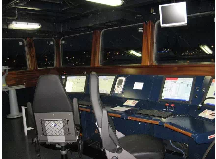
Rudder angle indicator, as the name indicates, provides the angle of the rudder. The display is provided on the navigation bridge equipment console so that the ship navigation officer can control the rate of turn and rudder angle of the ship. The indication is also provided in the bridge wing and engine control room.
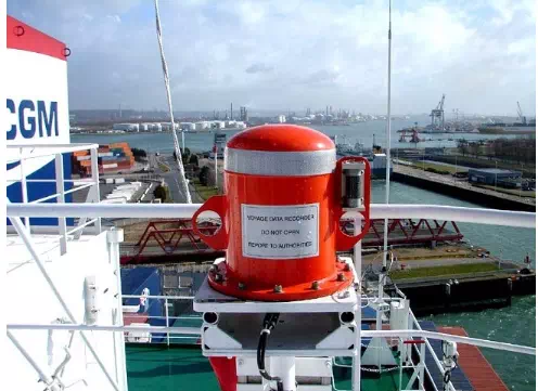
13. Voyage Data Recorder
A VDR or voyage data recorder is a crucial instrument among the ship navigation equipment list which is installed on a ship to continuously record vital information related to the operation of a vessel. It contains a voice recording system for a period of at least the last 12 hours. This recording is recovered and made use of for investigation in events of accidents. The importance of VDR is similar to a “black box” installed on an airplane.
14. Rate of turn indicator
This navigational tool indicates how fast the ship is turning at a steady rate (useful during pilotage and manoeuvring), normally shown as a number of degrees turned.The rate a ship is turning is measured in degrees per minute. This essential tool assists a coxswain in steering a course safely.
15. GPS Receiver
A Global Positioning System (GPS) receiver is a display system used to show the ship’s location with the help of Global positioning satellite in the earth’s orbit.
With the record of the ship’s positions, the speed, course, and the time is taken to cover the distance between “two marked positions” can be calculated.